

Ask someone to picture Florida, and they will probably think of a boot-shaped peninsula dangling off the southeaster United States. That mental image is not wrong, but it undersells the state.
Florida dimensions stretch across nearly 500 miles of coastline-hugging land, two time zones, and a climate range wide enough to grow both apples and mangoes within the same state line. Understanding Florida size means looking past the “boot” and into the actual numbers: square miles, coastline length, elevation, and population density.
This guide breaks all of it down. No filler, no vague guesses, just the real figures behind the Sunshine State’s shape, along with the geography, history, and regional differences that explain why Florida feels so much bigger than its rank on a map suggests.
Florida at a Glance
Florida is the third-most populous state in the country and the 22nd largest by total area. That combination, a mid-sized footprint packed with a huge population makes it one of the most densely developed large states in America.
| Metric | Figure |
|---|---|
| Total area | 65,758 square miles |
| Land area | 53,625 square miles |
| Water area | 12,133 square miles |
| National size rank | 22nd |
| Population (2024 est.) | approximately 23 million |
| Coastline length | 1,350 miles |
| Nickname | The Sunshine State |
What makes Florida geography unusual is not just the total number of square miles. It is the shape. Florida is long, narrow, and wrapped almost entirely by water, the Atlantic Ocean on one side, the Gulf of Mexico on the other.
That geography shapes everything from its climate zones to its highway system to how residents talk about “North Florida” versus “South Florida” as though they are different states entirely. In a lot of ways, they are.
Florida’s Dimensions, In Detail

Total Area (Land and Water Combined)
The size of sunshine state comes out to 65,758 square miles, which includes both land and inland/coastal water. Strip out the water, and Sunshine State still covers 53,625 square miles of land, roughly the size of England and Wales combined. Florida square miles rank it just behind New York and just ahead of Wisconsin on the national list, though it feels far larger once you factor in its odd, elongated shape.
Length, Northernmost Point to Key West
Sunshine state runs about 447 miles from its northern border with Georgia and Alabama down to Key West at the tip of the Florida Keys. That is longer than the distance from New York City to Detroit. Drive it in one shot, and you will cross swamp, scrubland, suburban sprawl, and finally a chain of coral islands connected by bridges, all without leaving the state.
Width, Panhandle’s West End to the Atlantic Coast
At its widest point, Florida stretches roughly 361 miles from Pensacola in the west to Jacksonville on the Atlantic coast. The state narrows dramatically as it heads south, though, until the peninsula is barely 100 miles across near Naples and Miami.
Coastline Length
Sunshine state coastline totals about 1,350 miles, second only to Alaska among U.S. states. Add in the tidal shoreline every inlet, bay, and estuary edge and the number balloons past 8,400 miles. No other state in the contiguous U.S. touches two separate bodies of water (the Atlantic Ocean and the Gulf of Mexico) along such a long stretch of coast.
Elevation Range, Highest and Lowest Points
Sunshine state is famously flat. Britton Hill, its highest natural point, sits at just 345 feet above sea level, the lowest “high point” of any U.S. state. At the other end, huge portions of South Florida sit at or barely above sea level, which is part of why the state faces such serious flooding and erosion concerns during hurricane season.
How Florida Stacks Up
Florida vs. Other U.S. States
| State | Total Area (sq mi) | Size Rank |
|---|---|---|
| Alaska | 665,384 | 1 |
| Texas | 268,596 | 2 |
| California | 163,695 | 3 |
| Georgia | 59,425 | 24 |
| Florida | 65,758 | 22 |
| New York | 54,555 | 27 |
is smaller than Texas and California by a wide margin, but it packs a similar cultural and economic punch thanks to its population density and tourism draw.
Learn how big 5 inches really is with everyday objects and simple comparisons.
Florida vs. Countries
Compared internationally, Florida size lands close to Greece (50,949 sq mi) or a bit larger than England (50,301 sq mi). It is also roughly the size of Cuba, its neighbor across the Straits of Florida, a fitting comparison given how closely the two share climate, culture, and coastline character.
Land Area vs. Water Area
Water makes up about 18% of Florida’s total area, one of the highest ratios of any U.S. state. Between the Everglades, thousands of lakes, rivers, and an enormous underground aquifer system, Sunshine state is arguably as much a water state as a land state.
Why Florida Is Shaped the Way It Is

The Peninsula: Millions of Years in the Making
Florida’s peninsula formed from a limestone platform that spent millions of years underwater before sea-level changes exposed it. That limestone base is porous, which is why Florida has so many natural springs, sinkholes, and underground caves, the land itself is essentially a giant, water-soaked sponge.
The Panhandle: A Historical and Geographic Explainer
The Florida Panhandle, that narrow strip running west toward Alabama, exists partly because of colonial-era border negotiations rather than any single natural boundary. It gives a foothold on the Gulf Coast far from the peninsula, which is why Pensacola feels culturally closer to Alabama than to Miami.
How Borders Were Set
Spain first claimed Florida in the 1500s, and the Spanish discovery of Florida by Juan Ponce de León in 1513 marks the earliest recorded European contact with the region. Spain ceded Florida to the United States in 1821 through the Adams-Onís Treaty. After the Seminole Wars, Florida statehood was granted in 1845, making it the 27th state in the Union.
Florida state history took another sharp turn 16 years later when seceded and joined the Confederacy. Florida Civil War history includes battles like Olustee, the state’s largest Civil War engagement.
“Florida is a land of contrasts, a place where 16th-century Spanish forts sit less than an hour from 21st-century rocket launch pads.” A fitting summary of how Florida history spans nearly 500 years of change packed into one narrow peninsula.
Learn about Red Bull can sizes, heights, and dimensions.
What Florida’s Size Means in Real Life
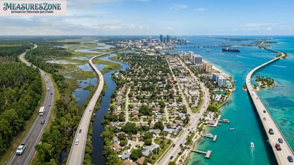
How Long It Takes to Drive Florida End to End
Driving from Pensacola to Key West takes roughly 10 hours without stops, covering close to 800 miles of actual road distance (longer than the straight-line width because of the state’s curved shape). That is a longer drive than Pensacola to Atlanta, Georgia, a fact that surprises a lot of first-time visitors.
Time Zones, Why Florida Has Two
Most of sunshine state sits in the Eastern time zone, but the Panhandle west of the Apalachicola River runs on Central time. That means it is possible to drive an hour and cross into an entirely different hour of the day, something few other states can claim.
Climate Range North to South
Florida climate zones shift dramatically from north to south. Pensacola experiences a humid subtropical climate with occasional winter frost, while Key West sits solidly in a tropical climate zone and almost never sees temperatures drop below 50°F.
South Florida climate supports mangroves, coral reefs, and tropical fruit trees that simply can not survive further north in the state. Florida weather also means one thing statewide: hurricane season, which runs from June through November and shapes building codes, insurance costs, and everyday life across the peninsula.
How Florida’s Length Creates Distinct Regions

Because Florida stretches so far north to south, it naturally splits into recognizable Florida regions:
- Florida Panhandle: Gulf Coast beaches, pine forests, closer culturally to the Deep South
- Central Florida: Orlando, theme parks, citrus groves, and inland lakes
- South Florida: Miami, dense urban sprawl, tropical climate, and the gateway to the Florida Keys
- The Florida Keys: a chain of coral islands stretching another 120 miles past the mainland
Each region feels almost like its own small state, connected by geography but separated by climate, culture, and pace of life.
Learn the standard Pokémon card size and dimensions.
Population Density and Land Use

Population per Square Mile
Sunshine state population growth has been relentless. With about 23 million residents packed into 53,625 square miles of land, sunshine state population density averages roughly 410 people per square mile, well above the national average. Florida demographics also show a notably higher median age than most states, driven by decades of retirees relocating to its warm climate zones.
Urban Areas vs. Undeveloped Land
Despite the growth, sunshine state still protects enormous stretches of undeveloped land. Everglades National Park alone covers 1.5 million acres, and the state maintains dozens of additional forests, preserves, and wildlife refuges.
How Much of Florida Is Actually Wetland
Wetlands cover close to 30% of the state’s land area. That includes the Everglades, one of the largest subtropical wetland ecosystems on Earth, along with countless smaller marshes, swamps, and floodplains that support Florida’s rich biodiversity.
How Florida’s Geography Shapes Its Economy and Attractions

Florida’s size and shape do not just determine drive times and time zones, they have quietly built the entire Florida economy. A long coastline, a warm climate, and a peninsula surrounded by two oceans turned Florida into one of the most geography-dependent economies in the country.
Tourism
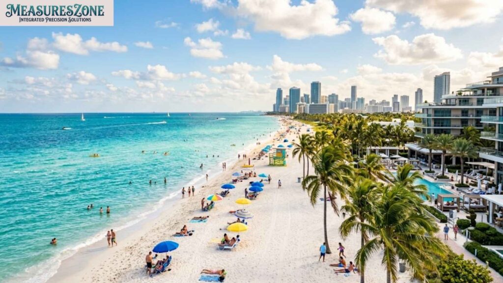
Tourism leads the list. Central Florida’s flat, inland terrain gave Walt Disney World the space it needed back in the 1960s, and that single decision turned Orlando into the most-visited destination in the country.
Meanwhile, Florida’s 1,350 miles of coastline support an entirely separate tourism economy built around Florida beaches, Miami Beach, Clearwater Beach, and Siesta Key Beach each draw millions of visitors chasing the same warm-water climate zones described earlier in this guide.
Agriculture
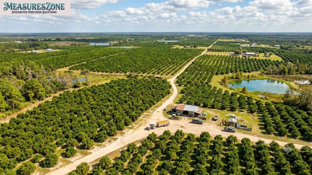
Agriculture depends just as heavily on geography. Central Florida’s climate zone, wedged between the frost line up north and the tropical heat down south, happens to be nearly perfect for citrus production, which is why sunshine state has produced the majority of the nation’s oranges for most of the past century.
Find easy ways to visualise 2 inches.
Aerospace

Aerospace tells a similar story. The Space Coast, on Florida’s Atlantic-facing peninsula, was chosen for its coastal location and proximity to the equator, both of which make rocket launches safer and more fuel-efficient. That is how a stretch of Florida coastline became home to Kennedy Space Centre and one of the busiest launch complexes on Earth.
Florida ecosystems
Sunshine state ecosystems include Everglades National Park, one of the world’s largest wetland systems, home to alligators, manatees, and hundreds of bird species. Offshore, the Florida Reef, the third-largest coral reef system on the planet, supports marine ecosystems around the Florida Keys. Sunshine state biodiversity is a direct result of the state’s unusual shape, climate zones, wetlands, and coastline.
FAQs About Florida’s Size
1. How many square miles is Florida?
Sunshine state covers 65,758 square miles total, including 53,625 square miles of land and 12,133 square miles of water.
2. Is Florida bigger than England?
Yes, slightly. Florida’s land area (53,625 sq mi) is larger than England’s (50,301 sq mi), though the two are close in overall scale.
3. How long would it take to drive across Florida?
Driving the full length, from Pensacola to Key West, takes around 10 hours and covers nearly 800 miles of road.
4. What is the widest point of Florida?
Florida’s widest point runs about 361 miles, from Pensacola on the Gulf Coast to Jacksonville on the Atlantic coast.
Conclusion
Florida dimensions tell a bigger story than a single number ever could. This is a state defined by contrast. It is a narrow peninsula that stretches nearly 450 miles and has more coastline than anywhere else in the country. It also has a climate line sharp enough to separate frost from palm trees. Florida geography, history, and population growth all trace back to that unusual shape: long, flat, and water-bound.
It is impossible to sum up with a single mental image of a “boot.”
Whether you are comparing Florida size to a neighboring state or planning a drive from the Panhandle to the Keys, the numbers hold up. You might even be settling a bar bet about how many Rhode Islands fit inside it. Florida earns its scale not through size, but through the variety packed into every one of its 65,758 square miles.
See how long 6 inches is using everyday objects.

Sam Glen is an experienced blogger and the author of the Dimension category at Measures Zone. He specializes in creating accurate, easy-to-understand size and dimension guides, helping readers quickly find reliable information for everyday objects and products.